Geolocate

Fort Yukon topographic map

Click on the map to display elevation.

Fort Yukon

On February 7, 1984, a Terrier Malemute-type sounding rocket, with a maximum altitude of 310 miles (500 km), was launched from Fort Yukon.

Wikipedia (CC-BY-SA 3.0)

About this map

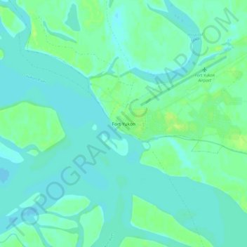
Name: Fort Yukon topographic map, elevation, terrain.

Location: Fort Yukon, Unorganized Borough, Alaska, 99740, United States (66.54472 -145.29389 66.58472 -145.25389)

Average elevation: 436 ft

Minimum elevation: 423 ft

Maximum elevation: 459 ft

Unorganized Borough trails, hiking, mountain biking, running and outdoor activities

Gear up for your next adventure:

🧦Hiking Socks - Comfortable socks to prevent blisters on long hikes
🎒Day Hiking Backpack - Lightweight backpack perfect for day trips and outdoor adventures
🔪Outdoor Multitools - Essential survival tools for gear repair and field use
🪶Trail Camera - Capture wildlife on your hikes
🥘Titanium Cookware - Durable, featherlight pots and pans for backpacking

As an Amazon Associate, this site earns from qualifying purchases at no extra cost to you.