Geolocate

Kyamugongo topographic map

Click on the map to display elevation.

About this map

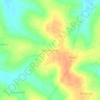
Name: Kyamugongo topographic map, elevation, terrain.

Location: Kyamugongo, Kayunga, Central Region, Uganda (0.93293 32.85423 0.97293 32.89423)

Average elevation: 3,527 ft

Minimum elevation: 3,461 ft

Maximum elevation: 3,593 ft

Gear up for your next adventure:

🧤Hiking Gloves - Protective gloves for rugged trails
🌄Hiking Binoculars - Compact binoculars for scenic views and trail spotting
🪶Compact Camp Shovel - Folding shovel for campsite tasks
Camping Coffee Makers - Enjoy premium coffee at the summit or campsite
🪶Fire Starter Kit - Reliable fire starter for survival and camping

As an Amazon Associate, this site earns from qualifying purchases at no extra cost to you.