Geolocate

Tabalong topographic map

Click on the map to display elevation.

About this map

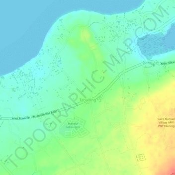
Name: Tabalong topographic map, elevation, terrain.

Location: Tabalong, Dauis, Bohol, Central Visayas, 6339, Philippines (9.61320 123.80960 9.63724 123.82621)

Average elevation: 62 ft

Minimum elevation: -7 ft

Maximum elevation: 180 ft

Other topographic maps

Click on a map to view its topography, its elevation and its terrain.

San Agustin

Philippines > Bohol > Dauis > Bingag

Average elevation: 33 ft

Gear up for your next adventure:

🧯Emergency Survival Kit - All‑in‑one survival essentials for the backcountry
🏕️Tent Footprint - Protect your tent base from wear
🌎3D Topographic Globes - Raised relief globes for a tactile understanding of geography
📦Dry Bags Set - Waterproof storage for electronics and clothes
🪶Camping Sleeping Pad - Comfortable sleeping pad for backpacking

As an Amazon Associate, this site earns from qualifying purchases at no extra cost to you.