Geolocate

Tezpur topographic map

Click on the map to display elevation.

About this map

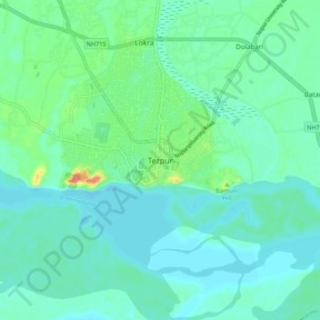
Name: Tezpur topographic map, elevation, terrain.

Location: Tezpur, Sonitpur, Assam, 784001, India (26.58299 92.75761 26.66299 92.83761)

Average elevation: 223 ft

Minimum elevation: 177 ft

Maximum elevation: 397 ft

Other topographic maps

Click on a map to view its topography, its elevation and its terrain.

Tezpur

India > Assam > Tezpur

Average elevation: 223 ft

Gear up for your next adventure:

🥘Titanium Cookware - Durable, featherlight pots and pans for backpacking
📡Handheld GPS Device - Reliable handheld GPS for outdoor navigation
🔋Rechargeable Batteries - Power up your outdoor devices
🧭Pro Hiking Compasses - High-accuracy liquid-filled compasses for topographic orientation
🥾Hiking Shoes - Durable and comfortable shoes for trail hiking

As an Amazon Associate, this site earns from qualifying purchases at no extra cost to you.