
Thank you for supporting this site ❤️
Make a donation
Make a donation
Gear up for your next adventure:
As an Amazon Associate, this site earns from qualifying purchases at no extra cost to you.
Pezuapa topographic map
Click on the map to display elevation.
Thank you for supporting this site ❤️
Make a donation
Make a donation
Gear up for your next adventure:
As an Amazon Associate, this site earns from qualifying purchases at no extra cost to you.
About this map
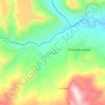
Name: Pezuapa topographic map, elevation, terrain.
Location: Pezuapa, Tetipac, Guerrero, México (18.63183 -99.60501 18.67183 -99.56501)
Average elevation: 4,436 ft
Minimum elevation: 3,563 ft
Maximum elevation: 5,738 ft
Thank you for supporting this site ❤️
Make a donation
Make a donation
Gear up for your next adventure:
As an Amazon Associate, this site earns from qualifying purchases at no extra cost to you.