Geolocate

Deesa topographic map

Click on the map to display elevation.

About this map

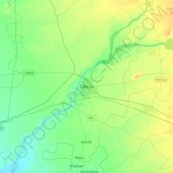
Name: Deesa topographic map, elevation, terrain.

Location: Deesa, Deesa Taluka, Banaskantha, Gujarat, 385500, India (24.09950 72.02033 24.41950 72.34033)

Average elevation: 476 ft

Minimum elevation: 292 ft

Maximum elevation: 974 ft

Gear up for your next adventure:

📡Handheld GPS Device - Reliable handheld GPS for outdoor navigation
🦶Carbon Trekking Poles - Reduce knee impact on steep descents with ultra-light poles
🔥Fast-Boil Camping Stoves - Efficient cooking systems for quick trail meals
🔭Stargazing Telescopes - Perfect for camping in low-light pollution areas shown on maps
🧭Hiking Compass - Precision compass for reliable navigation in the wilderness

As an Amazon Associate, this site earns from qualifying purchases at no extra cost to you.