
Thank you for supporting this site ❤️
Make a donation
Make a donation
Gear up for your next adventure:
As an Amazon Associate, this site earns from qualifying purchases at no extra cost to you.
Har Keren topographic map
Click on the map to display elevation.
Thank you for supporting this site ❤️
Make a donation
Make a donation
Gear up for your next adventure:
As an Amazon Associate, this site earns from qualifying purchases at no extra cost to you.
About this map
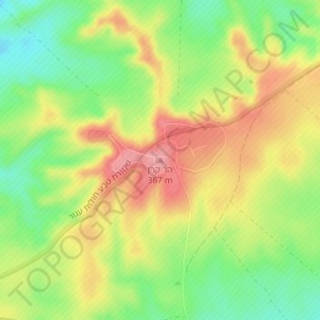
Name: Har Keren topographic map, elevation, terrain.
Location: Har Keren, Ramat Negev Regional Council, Israel (30.99430 34.49157 30.99440 34.49167)
Average elevation: 1,063 ft
Minimum elevation: 892 ft
Maximum elevation: 1,234 ft
Thank you for supporting this site ❤️
Make a donation
Make a donation
Gear up for your next adventure:
As an Amazon Associate, this site earns from qualifying purchases at no extra cost to you.