Geolocate

Hagala State topographic map

Click on the map to display elevation.

About this map

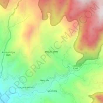
Name: Hagala State topographic map, elevation, terrain.

Location: Hagala State, Kandy District, Central Province, Sri Lanka (7.39002 80.74511 7.43002 80.78511)

Average elevation: 3,445 ft

Minimum elevation: 1,867 ft

Maximum elevation: 5,302 ft

Other topographic maps

Click on a map to view its topography, its elevation and its terrain.

Matale District

Sri Lanka > Central Province

Average elevation: 886 ft

Upper Kotmale Dam

Sri Lanka > Central Province > Talawakele > Holyrood

Average elevation: 4,098 ft

Sigiriya

Sri Lanka > Central Province

Average elevation: 666 ft

Nuwara Eliya District

Sri Lanka > Central Province

Average elevation: 3,586 ft

Pitawala Pathana

Sri Lanka > Central Province

Average elevation: 2,421 ft

Canyon Dam

Sri Lanka > Central Province > Hapugastenne

Average elevation: 3,615 ft

Gear up for your next adventure:

🎒Waterproof Dry Bags - Keep your electronics and maps dry inside your pack
🪶LED Camping Lantern - Bright lantern for camp lighting
📷Action Cameras - Rugged cameras to document your journeys across rugged terrain
📷Action Camera - Capture your outdoor adventures in HD
🔦LED Headlamp - Bright and durable LED headlamp for night navigation

As an Amazon Associate, this site earns from qualifying purchases at no extra cost to you.