
Thank you for supporting this site ❤️
Make a donation
Make a donation
Gear up for your next adventure:
As an Amazon Associate, this site earns from qualifying purchases at no extra cost to you.
Mühlenberge topographic map
Click on the map to display elevation.
Thank you for supporting this site ❤️
Make a donation
Make a donation
Gear up for your next adventure:
As an Amazon Associate, this site earns from qualifying purchases at no extra cost to you.
About this map
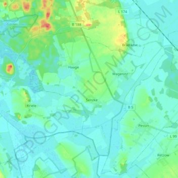
Name: Mühlenberge topographic map, elevation, terrain.
Location: Mühlenberge, Friesack, Havelland, Brandenburg, Deutschland (52.62460 12.51916 52.70341 12.69175)
Average elevation: 115 ft
Minimum elevation: 85 ft
Maximum elevation: 246 ft
Thank you for supporting this site ❤️
Make a donation
Make a donation
Gear up for your next adventure:
As an Amazon Associate, this site earns from qualifying purchases at no extra cost to you.