
Kalattiyur topographic map
Click on the map to display elevation.
About this map
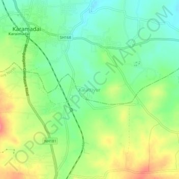
Name: Kalattiyur topographic map, elevation, terrain.
Average elevation: 1,237 ft
Minimum elevation: 1,138 ft
Maximum elevation: 1,378 ft
Other topographic maps
Click on a map to view its topography, its elevation and its terrain.
Mettupalayam
India > Tamil Nadu > Mettupalayam
Mettupalayam is located at 11°18′00″N 76°57′00″E / 11.3000°N 76.9500°E / 11.3000; 76.9500. It has an average elevation of 314 metres (1033 feet). Mettupalayam is situated on the bank of Bhavani River at the foot of the Nilgiri mountains.
Average elevation: 1,053 ft
Mettupalayam
India > Tamil Nadu > Mettupalayam
Mettupalayam is located at 11°18′20″N 76°56′06″E / 11.3056°N 76.9350°E / 11.3056; 76.9350. It has an average elevation of 314 m (1,030 ft). Mettupalayam is situated on the bank of Bhavani River at the foot of the Nilgiri mountains.
Average elevation: 1,053 ft