
Randwijk topographic map
Interactive map
Click on the map to display elevation.
About this map
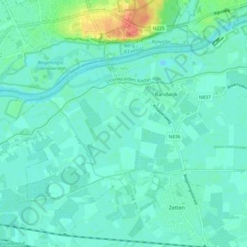
Name: Randwijk topographic map, elevation, terrain.
Location: Randwijk, Overbetuwe, Gelderland, Netherlands, The Netherlands (51.92961 5.64632 51.96387 5.73413)
Average elevation: 33 ft
Minimum elevation: 3 ft
Maximum elevation: 154 ft
Other topographic maps
Click on a map to view its topography, its elevation and its terrain.
Elst
The Netherlands > Gelderland > Overbetuwe
Elst, Overbetuwe, Gelderland, Netherlands, The Netherlands
Average elevation: 33 ft
Zetten
The Netherlands > Gelderland > Overbetuwe
Zetten, Overbetuwe, Gelderland, Netherlands, The Netherlands
Average elevation: 26 ft
Overbetuwe
The Netherlands > Gelderland > Overbetuwe
Overbetuwe, Gelderland, Netherlands, The Netherlands
Average elevation: 43 ft