
Uthai Thani Province topographic map
Interactive map
Click on the map to display elevation.
About this map
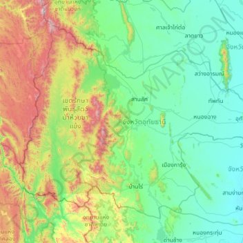
Name: Uthai Thani Province topographic map, elevation, terrain.
Location: Uthai Thani Province, Thailand (14.93793 98.98530 15.78277 100.10695)
Average elevation: 1,158 ft
Minimum elevation: 30 ft
Maximum elevation: 5,682 ft
Other topographic maps
Click on a map to view its topography, its elevation and its terrain.
Nong Chang
Thailand > Uthai Thani Province > Nong Chang
Nong Chang, Uthai Thani Province, 61110, Thailand
Average elevation: 164 ft