
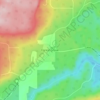
Forest Grove topographic map
Interactive map
Click on the map to display elevation.
About this map
Name: Forest Grove topographic map, elevation, terrain.
Average elevation: 3,009 ft
Minimum elevation: 2,671 ft
Maximum elevation: 3,491 ft
Other topographic maps
Click on a map to view its topography, its elevation and its terrain.
Lang Lake
Canada > British Columbia > Cariboo Regional District > Area H (Canim Lake/Forest Grove)
Lang Lake, Area H (Canim Lake/Forest Grove), Cariboo Regional District, British Columbia, Canada
Average elevation: 3,153 ft
Canim Lake
Canada > British Columbia > Cariboo Regional District > Area H (Canim Lake/Forest Grove)
Canim Lake, Area H (Canim Lake/Forest Grove), Cariboo Regional District, British Columbia, V0K 1J0, Canada
Average elevation: 3,071 ft