Geolocate

Emery Place topographic map

Click on the map to display elevation.

About this map

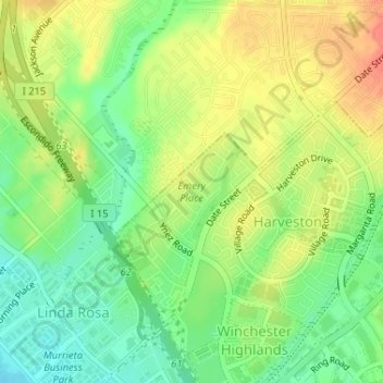
Name: Emery Place topographic map, elevation, terrain.

Location: Emery Place, Temecula, Riverside County, California, United States (33.53570 -117.16806 33.54405 -117.16168)

Average elevation: 1,102 ft

Minimum elevation: 1,024 ft

Maximum elevation: 1,181 ft

Other topographic maps

Click on a map to view its topography, its elevation and its terrain.

Crystal Ridge

United States > California > Riverside County > Temecula

Average elevation: 1,211 ft

Gear up for your next adventure:

🧭Hiking Compass - Precision compass for reliable navigation in the wilderness
📦Gear Storage Bags - Organize and protect outdoor equipment
🧣Hiking Neck Gaiter - Multi‑use neck protection for outdoor weather
🥄Camping Utensil Set - Lightweight utensils for outdoor meals
🏕️Tent Footprint - Protect your tent base from wear

As an Amazon Associate, this site earns from qualifying purchases at no extra cost to you.