
Charitas topographic map
Click on the map to display elevation.
About this map
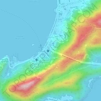
Name: Charitas topographic map, elevation, terrain.
Average elevation: 256 ft
Minimum elevation: -10 ft
Maximum elevation: 978 ft
Other topographic maps
Click on a map to view its topography, its elevation and its terrain.
Morro da Ponta da Armação
Brasil > Rio de Janeiro > Região Metropolitana do Rio de Janeiro > Niterói > Região Praias da Baía
Average elevation: 26 ft