Geolocate

Rømø topographic map

Click on the map to display elevation.

About this map
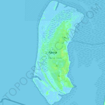
Name: Rømø topographic map, elevation, terrain.

Location: Rømø, Region of Southern Denmark, 6792, Denmark (55.06014 8.46342 55.20949 8.59285)

Average elevation: 0 ft

Minimum elevation: -16 ft

Maximum elevation: 23 ft

Other topographic maps

Click on a map to view its topography, its elevation and its terrain.

Vandel

Denmark > Region of Southern Denmark

Average elevation: 256 ft

Gear up for your next adventure:

🧢Outdoor Hiking Hat - Sun protection hat for outdoor explorers
🎒Trail Energy Bars - High‑calorie bars for hiking energy
🪄Magnetic Compass - Accurate compass for navigation
🧷Carabiner Set - Durable clips for gear attachment
🗺️NatGeo Topo Maps - High-quality waterproof printed topographic maps of US Parks

As an Amazon Associate, this site earns from qualifying purchases at no extra cost to you.