
Thank you for supporting this site ❤️
Make a donation
Make a donation
Gear up for your next adventure:
As an Amazon Associate, this site earns from qualifying purchases at no extra cost to you.
Djúpivogur topographic map
Click on the map to display elevation.
Thank you for supporting this site ❤️
Make a donation
Make a donation
Gear up for your next adventure:
As an Amazon Associate, this site earns from qualifying purchases at no extra cost to you.
About this map
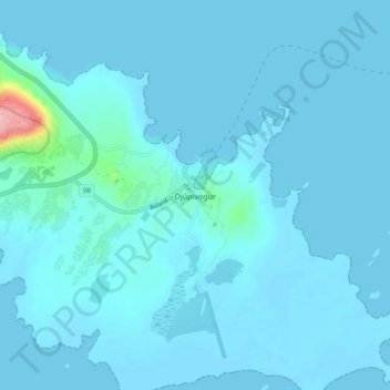
Name: Djúpivogur topographic map, elevation, terrain.
Location: Djúpivogur, Múlaþing, Eastern Region, 765, Iceland (64.63578 -14.30210 64.67578 -14.26210)
Average elevation: 26 ft
Minimum elevation: -7 ft
Maximum elevation: 479 ft
Thank you for supporting this site ❤️
Make a donation
Make a donation
Gear up for your next adventure:
As an Amazon Associate, this site earns from qualifying purchases at no extra cost to you.