Geolocate

Costa topographic map

Click on the map to display elevation.

About this map

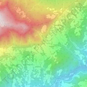
Name: Costa topographic map, elevation, terrain.

Location: Costa, Bardi, Parma, Emilia-Romagna, Italy (44.64809 9.78235 44.68809 9.82235)

Average elevation: 2,270 ft

Minimum elevation: 1,027 ft

Maximum elevation: 4,075 ft

Gear up for your next adventure:

🧷Carabiner Set - Durable clips for gear attachment
🔊Portable Camp Speaker - Music and alerts at camp
🛠️Backpacking Tool Kit - Essential toolkit for outdoor repairs
🪶Thermal Camp Blanket - Extra warmth for cold nights
🚁Photography Drones - Capture stunning aerial views of landforms and topography

As an Amazon Associate, this site earns from qualifying purchases at no extra cost to you.