Geolocate

Jennings topographic map

Click on the map to display elevation.

About this map

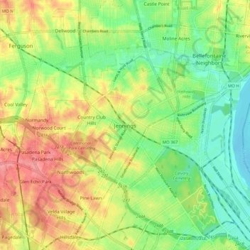
Name: Jennings topographic map, elevation, terrain.

Location: Jennings, Saint Louis County, Missouri, 63136, United States (38.67918 -90.30112 38.75918 -90.22112)

Average elevation: 518 ft

Minimum elevation: 394 ft

Maximum elevation: 676 ft

Gear up for your next adventure:

🪶Multi‑Purpose Knife - Useful blade for camp and trail
🏫Relief Map Kits - Hands-on tools for teaching landforms and elevation
📱Heavy-Duty Phone Cases - Drop-proof and waterproof protection for outdoor navigation
🚁Photography Drones - Capture stunning aerial views of landforms and topography
🧥Men's Rain Shells - Premium waterproof and breathable jackets for mountain weather

As an Amazon Associate, this site earns from qualifying purchases at no extra cost to you.