Geolocate

Clay Center topographic map

Click on the map to display elevation.

👉 Easily get elevation data in JSON, GeoTIFF and KML formats using Elevation API
Thank you for supporting this site ❤️
Make a donation

About this map

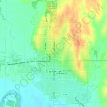
Name: Clay Center topographic map, elevation, terrain.

Location: Clay Center, Clay County, Kansas, United States (39.36493 -97.15521 39.40123 -97.10726)

Average elevation: 1,227 ft

Minimum elevation: 1,175 ft

Maximum elevation: 1,309 ft

Clay County trails, hiking, mountain biking, running and outdoor activities

Gear up for your next adventure:

🔪Outdoor Multitools - Essential survival tools for gear repair and field use
🪶Trail Camera - Capture wildlife on your hikes
👖Convertible Hiking Pants - Versatile zip-off pants for changing altitudes and temperatures
🎒Trail Energy Bars - High‑calorie bars for hiking energy
🌲Outdoor Survival Books - Best books on survival skills

As an Amazon Associate, this site earns from qualifying purchases at no extra cost to you.