Geolocate

Forest topographic map

Click on the map to display elevation.

About this map

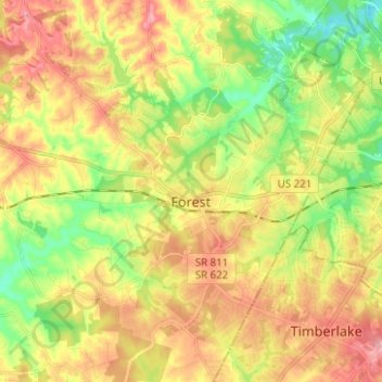
Name: Forest topographic map, elevation, terrain.

Location: Forest, Bedford County, Virginia, 24551, United States (37.31706 -79.34234 37.41619 -79.23274)

Average elevation: 840 ft

Minimum elevation: 643 ft

Maximum elevation: 1,050 ft

Bedford County trails, hiking, mountain biking, running and outdoor activities

Gear up for your next adventure:

📷Action Cameras - Rugged cameras to document your journeys across rugged terrain
🧢Sun Protection Hats - Wide-brimmed and UPF-rated hats for high-altitude sun safety
🛏️Cold Weather Sleeping Bag - Warm sleeping bag for cold conditions
🗃️Trail First Aid Kit - Essential kit for outdoor injuries and emergencies
🧺Microfiber Travel Towels - Compact and fast-drying towels for trail use

As an Amazon Associate, this site earns from qualifying purchases at no extra cost to you.