

Altamont topographic map
Click on the map to display elevation.
Altamont
Altamont was established in 1848 as a county seat for Grundy County, which had been created in 1844. General Adrian Northcutt, a prominent local farmer and military officer, was the prime advocate for the site's selection. The town's name comes from combining alto (meaning "altitude") and mont (meaning "mountain"). Although the Civil War somewhat stunted the town's growth, by 1870 Altamont's population had grown to 217.
About this map
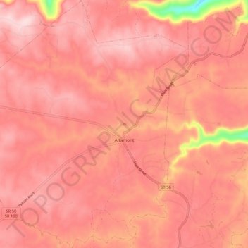
Name: Altamont topographic map, elevation, terrain.
Average elevation: 1,854 ft
Minimum elevation: 1,207 ft
Maximum elevation: 2,047 ft
Grundy County trails, hiking, mountain biking, running and outdoor activities
Other topographic maps
Click on a map to view its topography, its elevation and its terrain.
Stone Door Big Creek Gulf Overlook
United States > Tennessee > Grundy County
Average elevation: 1,604 ft
