
Dymchurch topographic map
Interactive map
Click on the map to display elevation.
About this map
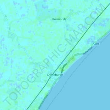
Name: Dymchurch topographic map, elevation, terrain.
Location: Dymchurch, Folkestone and Hythe, Kent, Angleterre, Royaume-Uni (51.01210 0.96874 51.05647 1.03525)
Average elevation: 3 ft
Minimum elevation: -7 ft
Maximum elevation: 20 ft
Other topographic maps
Click on a map to view its topography, its elevation and its terrain.
Folkestone
Royaume-Uni > Angleterre > Kent > Folkestone and Hythe
Folkestone, Folkestone and Hythe, Kent, Angleterre, Royaume-Uni
Average elevation: 203 ft
Postling
Royaume-Uni > Angleterre > Kent > Folkestone and Hythe
Postling, Folkestone and Hythe, Kent, Angleterre, Royaume-Uni
Average elevation: 367 ft