
Postling topographic map
Interactive map
Click on the map to display elevation.
About this map
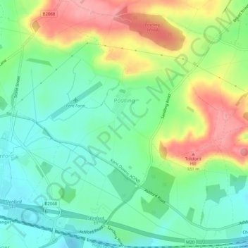
Name: Postling topographic map, elevation, terrain.
Location: Postling, Folkestone and Hythe, Kent, Angleterre, Royaume-Uni (51.09089 1.04158 51.12235 1.08301)
Average elevation: 367 ft
Minimum elevation: 223 ft
Maximum elevation: 607 ft
Other topographic maps
Click on a map to view its topography, its elevation and its terrain.
Folkestone
Royaume-Uni > Angleterre > Kent > Folkestone and Hythe
Folkestone, Folkestone and Hythe, Kent, Angleterre, Royaume-Uni
Average elevation: 203 ft
Dymchurch
Royaume-Uni > Angleterre > Kent > Folkestone and Hythe
Dymchurch, Folkestone and Hythe, Kent, Angleterre, Royaume-Uni
Average elevation: 3 ft