Geolocate

Sunday topographic map

Click on the map to display elevation.

About this map

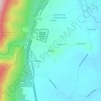
Name: Sunday topographic map, elevation, terrain.

Location: Sunday, Frederick County, Maryland, 21788, United States (39.56343 -77.44388 39.60343 -77.40388)

Average elevation: 564 ft

Minimum elevation: 328 ft

Maximum elevation: 1,532 ft

Frederick County trails, hiking, mountain biking, running and outdoor activities

Gear up for your next adventure:

🚗GPS Dash Cams - Record your scenic drives through mountain passes and canyons
🪶Trail Camera - Capture wildlife on your hikes
🎒Trekking Poles - Sturdy poles for balance and stability on rough terrain
📡Handheld GPS Device - Reliable handheld GPS for outdoor navigation
🥩Freeze-Dried Meals - Nutritious and lightweight food for remote expeditions

As an Amazon Associate, this site earns from qualifying purchases at no extra cost to you.