
Thank you for supporting this site ❤️
Make a donation
Make a donation
Gear up for your next adventure:
As an Amazon Associate, this site earns from qualifying purchases at no extra cost to you.
Kedgaon topographic map
Click on the map to display elevation.
Thank you for supporting this site ❤️
Make a donation
Make a donation
Gear up for your next adventure:
As an Amazon Associate, this site earns from qualifying purchases at no extra cost to you.
About this map
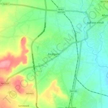
Name: Kedgaon topographic map, elevation, terrain.
Location: Kedgaon, Nagar, Ahmednagar, Maharashtra, 414005, India (19.02425 74.66448 19.10425 74.74448)
Average elevation: 2,178 ft
Minimum elevation: 2,077 ft
Maximum elevation: 2,375 ft
Thank you for supporting this site ❤️
Make a donation
Make a donation
Gear up for your next adventure:
As an Amazon Associate, this site earns from qualifying purchases at no extra cost to you.