
Muzaffarpur topographic map
Click on the map to display elevation.
Muzaffarpur
Muzaffarpur is located at 26°07′N 85°24′E / 26.12°N 85.4°E / 26.12; 85.4. The city lies in a highly active seismic zone of India. In the disastrous earthquake on 15 January 1934, much of the town suffered severe damage and many people died. It has an average elevation of 47 meters (154 feet). This saucer shaped, low-centered town lies on the great Indo-Gangetic plains of Bihar, over Himalayan silt and sand brought by the glacier-fed and rain-fed meandering rivers of the Himalayas.
About this map
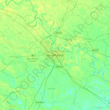
Name: Muzaffarpur topographic map, elevation, terrain.
Location: Muzaffarpur, Musahri, Muzaffarpur, Bihar, 842001, India (25.95829 85.22579 26.27829 85.54579)
Average elevation: 177 ft
Minimum elevation: 151 ft
Maximum elevation: 217 ft