Geolocate
👉 Easily get elevation data in JSON, GeoTIFF and KML formats using Elevation API
Thank you for supporting this site ❤️
Make a donation

Calapugan topographic map

Click on the map to display elevation.

About this map

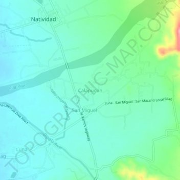
Name: Calapugan topographic map, elevation, terrain.

Location: Calapugan, Pangasinan, Ilocos Region, 2446, Philippines (16.00690 120.78549 16.04690 120.82549)

Average elevation: 315 ft

Minimum elevation: 233 ft

Maximum elevation: 620 ft

Gear up for your next adventure:

📻Weather Alert Radios - Stay informed of storm risks while off-the-grid
🔭Compact Binoculars - HD vision for scouting terrain and identifying distant landmarks
👟Trail Running Shoes - Lightweight shoes for trail runners
🕶️Glacier Sunglasses - Side shields to protect eyes from high-altitude snow glare
🛠️Outdoor Gear Repair Kit - Essential tools to fix gear on the trail

As an Amazon Associate, this site earns from qualifying purchases at no extra cost to you.