Geolocate

Terong topographic map

Click on the map to display elevation.

About this map

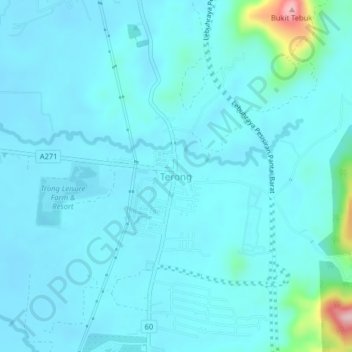
Name: Terong topographic map, elevation, terrain.

Location: Terong, Larut, Matang and Selama, Perak, Malaysia (4.68941 100.69982 4.72941 100.73982)

Average elevation: 82 ft

Minimum elevation: 7 ft

Maximum elevation: 745 ft

Gear up for your next adventure:

🗺️NatGeo Topo Maps - High-quality waterproof printed topographic maps of US Parks
🛶Inflatable Kayak - Portable kayak for rivers, lakes, and expeditions
🏕️Tent Footprint - Protect your tent base from wear
👟Men's Trail Runners - Lightweight footwear for fast-paced exploration and light hiking
📦Dry Bags Set - Waterproof storage for electronics and clothes

As an Amazon Associate, this site earns from qualifying purchases at no extra cost to you.