
Thank you for supporting this site ❤️
Make a donation
Make a donation
Gear up for your next adventure:
As an Amazon Associate, this site earns from qualifying purchases at no extra cost to you.
Béja topographic map
Click on the map to display elevation.
Thank you for supporting this site ❤️
Make a donation
Make a donation
Gear up for your next adventure:
As an Amazon Associate, this site earns from qualifying purchases at no extra cost to you.
About this map
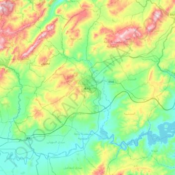
Name: Béja topographic map, elevation, terrain.
Location: Béja, باجة, معتمدية باجة الشمالية, Béja, 9000, Tunisia (36.56368 9.02538 36.88368 9.34538)
Average elevation: 945 ft
Minimum elevation: 338 ft
Maximum elevation: 2,326 ft
Thank you for supporting this site ❤️
Make a donation
Make a donation
Gear up for your next adventure:
As an Amazon Associate, this site earns from qualifying purchases at no extra cost to you.