Geolocate

Creedmoor topographic map

Click on the map to display elevation.

About this map

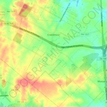
Name: Creedmoor topographic map, elevation, terrain.

Location: Creedmoor, Travis County, Texas, United States (30.03864 -97.76097 30.11451 -97.70588)

Average elevation: 663 ft

Minimum elevation: 558 ft

Maximum elevation: 784 ft

Travis County trails, hiking, mountain biking, running and outdoor activities

Gear up for your next adventure:

🎒Hydration Pack - Hands‑free water reservoir for long hikes
🚁Photography Drones - Capture stunning aerial views of landforms and topography
🛌Ultralight Sleeping Bags - Compact down bags for cold nights in the wilderness
🛶Inflatable Kayak - Portable kayak for rivers, lakes, and expeditions
🌎3D Topographic Globes - Raised relief globes for a tactile understanding of geography

As an Amazon Associate, this site earns from qualifying purchases at no extra cost to you.