Geolocate

Costales topographic map

Click on the map to display elevation.

About this map

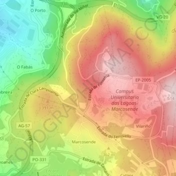
Name: Costales topographic map, elevation, terrain.

Location: Costales, Beade, Vigo, Pontevedra, Galicia, 36310, Spain (42.16159 -8.70088 42.18159 -8.68088)

Average elevation: 1,148 ft

Minimum elevation: 502 ft

Maximum elevation: 1,673 ft

Gear up for your next adventure:

🪶Wildlife Field Guides - Learn animal tracking and species ID
🧢Sun Protection Hats - Wide-brimmed and UPF-rated hats for high-altitude sun safety
🧭Orienteering Set - Complete compass and map reading kit
🦶Carbon Trekking Poles - Reduce knee impact on steep descents with ultra-light poles
🧦Hiking Socks - Comfortable socks to prevent blisters on long hikes

As an Amazon Associate, this site earns from qualifying purchases at no extra cost to you.