
Thank you for supporting this site ❤️
Make a donation
Make a donation
Gear up for your next adventure:
As an Amazon Associate, this site earns from qualifying purchases at no extra cost to you.
Ochamps topographic map
Click on the map to display elevation.
Thank you for supporting this site ❤️
Make a donation
Make a donation
Gear up for your next adventure:
As an Amazon Associate, this site earns from qualifying purchases at no extra cost to you.
About this map
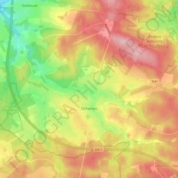
Name: Ochamps topographic map, elevation, terrain.
Location: Ochamps, Libin, Neufchâteau, Luxembourg, Wallonie, Belgique (49.90782 5.23702 49.95408 5.32982)
Average elevation: 1,460 ft
Minimum elevation: 1,148 ft
Maximum elevation: 1,722 ft
Thank you for supporting this site ❤️
Make a donation
Make a donation
Gear up for your next adventure:
As an Amazon Associate, this site earns from qualifying purchases at no extra cost to you.
Other topographic maps
Click on a map to view its topography, its elevation and its terrain.