Geolocate
👉 Easily get elevation data in JSON, GeoTIFF and KML formats using Elevation API
Thank you for supporting this site ❤️
Make a donation

Bongaon topographic map

Click on the map to display elevation.

About this map

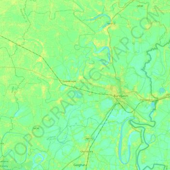
Name: Bongaon topographic map, elevation, terrain.

Location: Bongaon, North 24 Parganas, West Bengal, India (22.94571 88.66194 23.16767 88.89566)

Average elevation: 26 ft

Minimum elevation: -3 ft

Maximum elevation: 59 ft

Gear up for your next adventure:

🌡️Handheld Weather Meters - Measure wind, temp, and pressure for safe mountain travel
🧼Biodegradable Camping Soap - Eco‑friendly soap for outdoor hygiene
🛡️Bear Spray Outdoor - Protection in bear country hikes
🍳Camping Cook Set - Complete cookware for outdoor meals
🎒Hydration Pack - Hands‑free water reservoir for long hikes

As an Amazon Associate, this site earns from qualifying purchases at no extra cost to you.