Geolocate

Parque La Alborada topographic map

Click on the map to display elevation.

About this map

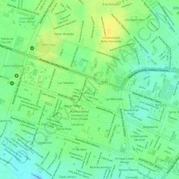
Name: Parque La Alborada topographic map, elevation, terrain.

Location: Parque La Alborada, Los Tallanes, Piura, Perú (-5.18555 -80.65428 -5.18443 -80.65343)

Average elevation: 121 ft

Minimum elevation: 79 ft

Maximum elevation: 157 ft

Other topographic maps

Click on a map to view its topography, its elevation and its terrain.

Plaza Tres Culturas

Perú > Piura > Piura

Average elevation: 105 ft

Piura

Perú > Piura > Piura

Average elevation: 226 ft

Los Ejidos del Norte

Perú > Piura > Piura

Average elevation: 128 ft

San Juan de Curumuy

Perú > Piura > Piura

Average elevation: 203 ft

Ejidos de Mariposa

Perú > Piura > Piura

Average elevation: 131 ft

Ejidos de Huan

Perú > Piura > Piura

Average elevation: 151 ft

Ejidos de Mariposa

Perú > Piura > Piura

Average elevation: 131 ft

Cerezal

Perú > Piura > Piura

Average elevation: 167 ft

A

Perú > Piura > Piura

Average elevation: 121 ft

Gear up for your next adventure:

🗃️Trail First Aid Kit - Essential kit for outdoor injuries and emergencies
💧Water Purification System - Clean water on the trail with reliable purifiers
🧢Outdoor Hiking Hat - Sun protection hat for outdoor explorers
📻Weather Alert Radios - Stay informed of storm risks while off-the-grid
📶Satellite Messenger - Communication device off‑grid

As an Amazon Associate, this site earns from qualifying purchases at no extra cost to you.