Geolocate

Mont-Blanc topographic map

Click on the map to display elevation.

About this map

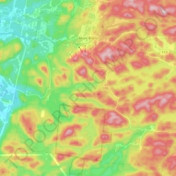
Name: Mont-Blanc topographic map, elevation, terrain.

Location: Mont-Blanc, Les Laurentides, Laurentides, Quebec, Canada (46.01869 -74.55558 46.13952 -74.38028)

Average elevation: 1,266 ft

Minimum elevation: 728 ft

Maximum elevation: 1,909 ft

Other topographic maps

Click on a map to view its topography, its elevation and its terrain.

Lac Xavier

Canada > Quebec > Les Laurentides > La Conception

Average elevation: 968 ft

The Edge

Canada > Quebec > Les Laurentides > Mont-Tremblant

Average elevation: 2,254 ft

Lac Besson

Canada > Quebec > Les Laurentides > Montcalm

Average elevation: 1,184 ft

Gear up for your next adventure:

📱Solar Portable Charger - Solar power bank for charging devices off‑grid
🚪Portable Camp Chair - Foldable chair for comfort at camp
🔦Powerful Headlamps - Ultra-bright hands-free lighting for night navigation
🔌USB Car Charger - Car charger for on‑the‑go power needs
🗺️NatGeo Topo Maps - High-quality waterproof printed topographic maps of US Parks

As an Amazon Associate, this site earns from qualifying purchases at no extra cost to you.