
Großbreitenbach topographic map
Click on the map to display elevation.
About this map
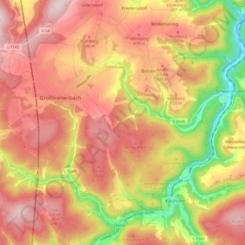
Name: Großbreitenbach topographic map, elevation, terrain.
Location: Großbreitenbach, Ilm-Kreis, Thuringia, Germany (50.54992 10.97003 50.59756 11.07645)
Average elevation: 1,955 ft
Minimum elevation: 1,227 ft
Maximum elevation: 2,441 ft