Geolocate

Sapang Balas topographic map

Click on the map to display elevation.

About this map

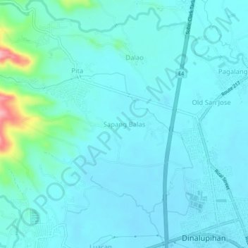
Name: Sapang Balas topographic map, elevation, terrain.

Location: Sapang Balas, Santo Niño, Dinalupihan, Bataan, Central Luzon, 2110, Philippines (14.86577 120.42775 14.90577 120.46775)

Average elevation: 79 ft

Minimum elevation: 20 ft

Maximum elevation: 476 ft

Other topographic maps

Click on a map to view its topography, its elevation and its terrain.

Gear up for your next adventure:

🚪Portable Camp Chair - Foldable chair for comfort at camp
🪄Magnetic Compass - Accurate compass for navigation
🔭Stargazing Telescopes - Perfect for camping in low-light pollution areas shown on maps
🧭Orienteering Set - Complete compass and map reading kit
🪶Fire Starter Kit - Reliable fire starter for survival and camping

As an Amazon Associate, this site earns from qualifying purchases at no extra cost to you.