
Thank you for supporting this site ❤️
Make a donation
Make a donation
Gear up for your next adventure:
As an Amazon Associate, this site earns from qualifying purchases at no extra cost to you.
田家寨镇 topographic map
Click on the map to display elevation.
Thank you for supporting this site ❤️
Make a donation
Make a donation
Gear up for your next adventure:
As an Amazon Associate, this site earns from qualifying purchases at no extra cost to you.
About this map
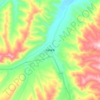
Name: 田家寨镇 topographic map, elevation, terrain.
Location: 田家寨镇, 湟中区, 西宁市, 青海省, 中国 (36.41236 101.75664 36.49236 101.83664)
Average elevation: 8,629 ft
Minimum elevation: 7,858 ft
Maximum elevation: 9,705 ft
Thank you for supporting this site ❤️
Make a donation
Make a donation
Gear up for your next adventure:
As an Amazon Associate, this site earns from qualifying purchases at no extra cost to you.