Geolocate

Weilersville topographic map

Click on the map to display elevation.

About this map

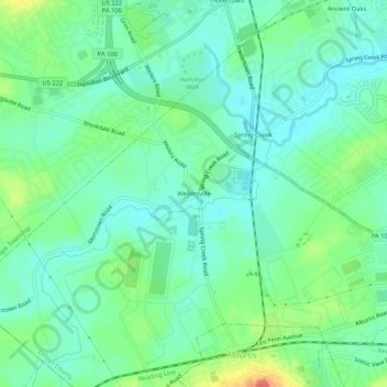
Name: Weilersville topographic map, elevation, terrain.

Location: Weilersville, Lower Macungie Township, Lehigh County, Pennsylvania, 18087, United States (40.50815 -75.63019 40.54815 -75.59019)

Average elevation: 413 ft

Minimum elevation: 361 ft

Maximum elevation: 538 ft

Other topographic maps

Click on a map to view its topography, its elevation and its terrain.

Gear up for your next adventure:

🧢Outdoor Hiking Hat - Sun protection hat for outdoor explorers
📱Solar Portable Charger - Solar power bank for charging devices off‑grid
🔪Outdoor Multitools - Essential survival tools for gear repair and field use
☀️Outdoor Sunscreen - High protection sunscreen for outdoor activities
🚁Photography Drones - Capture stunning aerial views of landforms and topography

As an Amazon Associate, this site earns from qualifying purchases at no extra cost to you.