
Thank you for supporting this site ❤️
Make a donation
Make a donation
Gear up for your next adventure:
As an Amazon Associate, this site earns from qualifying purchases at no extra cost to you.
Palumbanes topographic map
Click on the map to display elevation.
Thank you for supporting this site ❤️
Make a donation
Make a donation
Gear up for your next adventure:
As an Amazon Associate, this site earns from qualifying purchases at no extra cost to you.
About this map
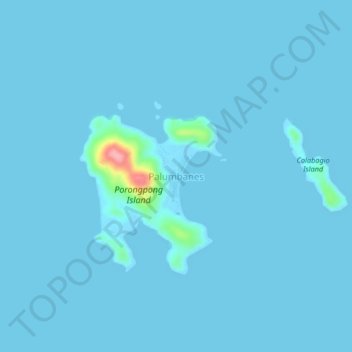
Name: Palumbanes topographic map, elevation, terrain.
Location: Palumbanes, Caramoan, Catanduanes, Bicol Region, Philippines (14.00504 124.02616 14.04504 124.06616)
Average elevation: 10 ft
Minimum elevation: -7 ft
Maximum elevation: 381 ft
Thank you for supporting this site ❤️
Make a donation
Make a donation
Gear up for your next adventure:
As an Amazon Associate, this site earns from qualifying purchases at no extra cost to you.