
Thank you for supporting this site ❤️
Make a donation
Make a donation
Gear up for your next adventure:
As an Amazon Associate, this site earns from qualifying purchases at no extra cost to you.
Motoyama topographic map
Click on the map to display elevation.
Thank you for supporting this site ❤️
Make a donation
Make a donation
Gear up for your next adventure:
As an Amazon Associate, this site earns from qualifying purchases at no extra cost to you.
About this map
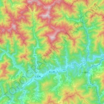
Name: Motoyama topographic map, elevation, terrain.
Location: Motoyama, Nagaoka County, Kochi Prefecture, 781-3601, Japan (33.70172 133.50651 33.88244 133.64331)
Average elevation: 2,228 ft
Minimum elevation: 692 ft
Maximum elevation: 4,869 ft
Thank you for supporting this site ❤️
Make a donation
Make a donation
Gear up for your next adventure:
As an Amazon Associate, this site earns from qualifying purchases at no extra cost to you.