Geolocate

Glenmont topographic map

Click on the map to display elevation.

About this map

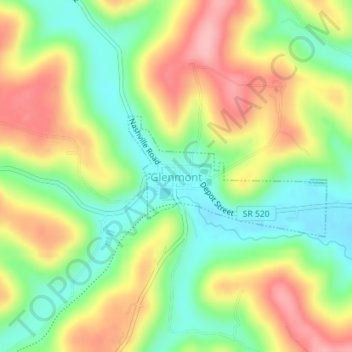
Name: Glenmont topographic map, elevation, terrain.

Location: Glenmont, Holmes County, Ohio, United States (40.51546 -82.10223 40.52471 -82.08218)

Average elevation: 1,053 ft

Minimum elevation: 846 ft

Maximum elevation: 1,302 ft

Holmes County trails, hiking, mountain biking, running and outdoor activities

Other topographic maps

Click on a map to view its topography, its elevation and its terrain.

Charm

United States > Ohio > Holmes County

Average elevation: 1,138 ft

Gear up for your next adventure:

🌧️Backpack Rain Cover - Keep gear dry in wet weather
🔋Solar Power Banks - Keep your GPS and phone charged in remote wilderness areas
🔌Solar Panel Charger - Charge gear sustainably outdoors
🧯Portable Fire Pit - Compact fire pit for camping spots
🦺Reflective Outdoor Gear - Safety gear for low‑light conditions

As an Amazon Associate, this site earns from qualifying purchases at no extra cost to you.