Geolocate

Mazatlán topographic map

Click on the map to display elevation.

Mazatlán

Its average elevation is 10 metres (33 ft) above sea level.

Wikipedia (CC-BY-SA 3.0)

About this map

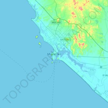
Name: Mazatlán topographic map, elevation, terrain.

Location: Mazatlán, Sinaloa, 82000, Mexico (23.04358 -106.58084 23.36358 -106.26084)

Average elevation: 62 ft

Minimum elevation: -7 ft

Maximum elevation: 961 ft

Gear up for your next adventure:

🔋Solar Power Banks - Keep your GPS and phone charged in remote wilderness areas
🔥Fast-Boil Camping Stoves - Efficient cooking systems for quick trail meals
🔭Stargazing Telescopes - Perfect for camping in low-light pollution areas shown on maps
Solar GPS Watches - Advanced multisport watches with built-in topographic maps
🌲Outdoor Survival Books - Best books on survival skills

As an Amazon Associate, this site earns from qualifying purchases at no extra cost to you.