Geolocate

Carver topographic map

Click on the map to display elevation.

About this map

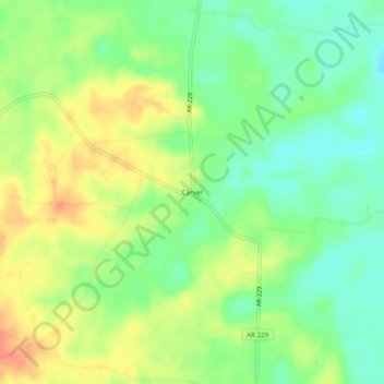
Name: Carver topographic map, elevation, terrain.

Location: Carver, Grant County, Arkansas, United States (34.19649 -92.63849 34.23649 -92.59849)

Average elevation: 246 ft

Minimum elevation: 177 ft

Maximum elevation: 325 ft

Grant County trails, hiking, mountain biking, running and outdoor activities

Other topographic maps

Click on a map to view its topography, its elevation and its terrain.

Poyen

United States > Arkansas > Grant County

Average elevation: 226 ft

Prattsville

United States > Arkansas > Grant County

Average elevation: 289 ft

Tull

United States > Arkansas > Grant County

Average elevation: 305 ft

Sheridan

United States > Arkansas > Grant County

Average elevation: 269 ft

Leola

United States > Arkansas > Grant County

Average elevation: 243 ft

Gear up for your next adventure:

🪶Paracord Bracelet - Survival bracelet with built‑in tools
🔭Compact Binoculars - HD vision for scouting terrain and identifying distant landmarks
🥘Titanium Cookware - Durable, featherlight pots and pans for backpacking
🥤Water Filter Bottle - All‑in‑one filter bottle for safe hydration
📖Nature Tracking Books - Learn to track wildlife and terrain

As an Amazon Associate, this site earns from qualifying purchases at no extra cost to you.