Geolocate

Millerstown topographic map

Click on the map to display elevation.

About this map

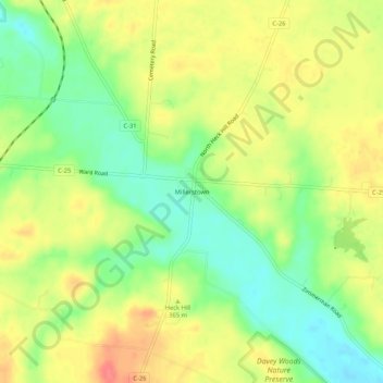
Name: Millerstown topographic map, elevation, terrain.

Location: Millerstown, Champaign County, Ohio, 43072, United States (40.13700 -83.94132 40.17700 -83.90132)

Average elevation: 1,171 ft

Minimum elevation: 1,070 ft

Maximum elevation: 1,273 ft

Champaign County trails, hiking, mountain biking, running and outdoor activities

Other topographic maps

Click on a map to view its topography, its elevation and its terrain.

North Lewisburg

United States > Ohio > Champaign County

Average elevation: 1,099 ft

Woodstock

United States > Ohio > Champaign County

Average elevation: 1,050 ft

Mutual

United States > Ohio > Champaign County

Average elevation: 1,204 ft

Mechanicsburg

United States > Ohio > Champaign County

Average elevation: 1,089 ft

Mad River

United States > Ohio > Champaign County > West Liberty

Average elevation: 1,106 ft

St. Paris

United States > Ohio > Champaign County

Average elevation: 1,224 ft

Christiansburg

United States > Ohio > Champaign County

Average elevation: 1,122 ft

Gear up for your next adventure:

🔋Rechargeable Batteries - Power up your outdoor devices
🪓Survival Multi‑Tool - Versatile tool for camp and trail tasks
📷Action Cameras - Rugged cameras to document your journeys across rugged terrain
🗺️Topographic Maps - Detailed topo maps for hiking, exploring and outdoor navigation
🖼️Topo Map Wall Art - Decorative topographic prints of famous peaks and regions

As an Amazon Associate, this site earns from qualifying purchases at no extra cost to you.