
Thank you for supporting this site ❤️
Make a donation
Make a donation
Gear up for your next adventure:
As an Amazon Associate, this site earns from qualifying purchases at no extra cost to you.
Mondrón topographic map
Click on the map to display elevation.
Thank you for supporting this site ❤️
Make a donation
Make a donation
Gear up for your next adventure:
As an Amazon Associate, this site earns from qualifying purchases at no extra cost to you.
About this map
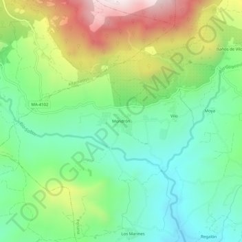
Name: Mondrón topographic map, elevation, terrain.
Location: Mondrón, Periana, La Axarquía, Malaga, Andalusia, 29710, Spain (36.91961 -4.24801 36.95961 -4.20801)
Average elevation: 1,890 ft
Minimum elevation: 955 ft
Maximum elevation: 3,622 ft
Thank you for supporting this site ❤️
Make a donation
Make a donation
Gear up for your next adventure:
As an Amazon Associate, this site earns from qualifying purchases at no extra cost to you.