Geolocate

Asana topographic map

Click on the map to display elevation.

About this map

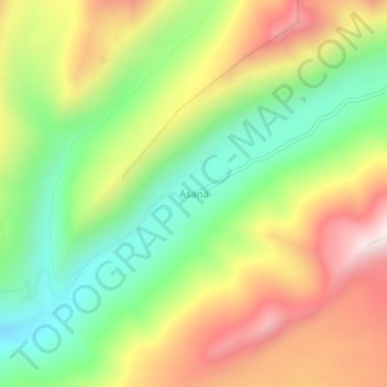
Name: Asana topographic map, elevation, terrain.

Location: Asana, Torata, Province of Mariscal Nieto, Moquegua, Peru (-17.08150 -70.54128 -17.04150 -70.50128)

Average elevation: 15,217 ft

Minimum elevation: 13,996 ft

Maximum elevation: 16,706 ft

Other topographic maps

Click on a map to view its topography, its elevation and its terrain.

Ilo

Peru > Moquegua

Average elevation: 331 ft

Province of Ilo

Peru > Moquegua

Average elevation: 2,139 ft

Gear up for your next adventure:

👟Men's Trail Runners - Lightweight footwear for fast-paced exploration and light hiking
🌡️Handheld Weather Meters - Measure wind, temp, and pressure for safe mountain travel
📡GPS Antenna Upgrade - Enhance GPS reception in remote terrain
Solar GPS Watches - Advanced multisport watches with built-in topographic maps
🔋Solar Power Banks - Keep your GPS and phone charged in remote wilderness areas

As an Amazon Associate, this site earns from qualifying purchases at no extra cost to you.