Geolocate

武都镇 topographic map

Interactive map

Click on the map to display elevation.

About this map

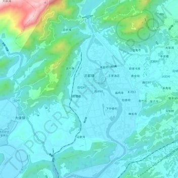
Name: 武都镇 topographic map, elevation, terrain.

Location: 武都镇, 江油市, 绵阳市, 四川省, 中国 (31.82679 104.75914 31.92583 104.85465)

Average elevation: 2,244 ft

Minimum elevation: 1,762 ft

Maximum elevation: 5,505 ft

Other topographic maps

Click on a map to view its topography, its elevation and its terrain.

枫顺乡

中国 > 四川省 > 江油市 > 绵阳市

枫顺乡, 江油市, 绵阳市, 四川省, 中国

Average elevation: 4,245 ft

青莲镇

中国 > 四川省 > 江油市 > 绵阳市

青莲镇, 江油市, 绵阳市, 四川省, 中国

Average elevation: 1,713 ft

厚坝镇

中国 > 四川省 > 江油市 > 绵阳市

厚坝镇, 江油市, 绵阳市, 四川省, 621715, 中国

Average elevation: 2,149 ft

重华镇

中国 > 四川省 > 江油市 > 绵阳市

重华镇, 江油市, 绵阳市, 四川省, 中国

Average elevation: 2,661 ft

八一镇

中国 > 四川省 > 江油市 > 绵阳市

八一镇, 江油市, 绵阳市, 四川省, 中国

Average elevation: 1,998 ft