Geolocate

Leiko topographic map

Click on the map to display elevation.

About this map

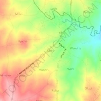
Name: Leiko topographic map, elevation, terrain.

Location: Leiko, Maracha, Northern Region, Uganda (3.30246 30.92522 3.34246 30.96522)

Average elevation: 3,753 ft

Minimum elevation: 3,494 ft

Maximum elevation: 3,976 ft

Gear up for your next adventure:

🔥Fast-Boil Camping Stoves - Efficient cooking systems for quick trail meals
👟Men's Trail Runners - Lightweight footwear for fast-paced exploration and light hiking
😴Insulated Sleeping Pads - Compact and warm pads for high-elevation camping
🌡️Handheld Weather Meters - Measure wind, temp, and pressure for safe mountain travel
🌧️Backpack Rain Cover - Keep gear dry in wet weather

As an Amazon Associate, this site earns from qualifying purchases at no extra cost to you.